

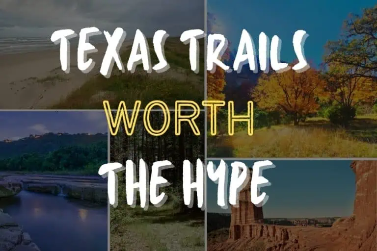
Texas covers 268,000 square miles across distinct ecological regions from desert mountains in the west, canyon country in the Panhandle, granite domes and limestone hills in the center, and pine forest, coastal barrier islands, and subtropical wetland to the east and south.
Few states pack that much terrain variation into a single set of borders, and fewer still get credit for it outside their own hiking communities.
This guide covers ten trails spanning the state, from a 1.8-mile granite scramble to a 30-mile backcountry loop. All will blow your mind!
Santa Elena Canyon Trail Squeezes the Rio Grande Between Canyon Walls Hundreds of Feet Tall
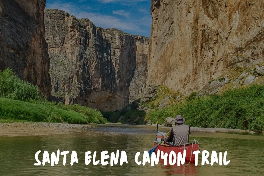
The Santa Elena Canyon Trail in Big Bend National Park follows the Rio Grande directly into the canyon mouth, where walls rise hundreds of feet on both sides within the first half mile.
One trail that stays with you long after the hike is the Santa Elena Canyon Trail in Big Bend National Park.
It is not the longest or most difficult route, yet it offers a kind of quiet scale that is hard to find elsewhere in Texas.
You start along the Rio Grande, then gradually move into towering canyon walls that rise hundreds of feet on both sides. The contrast between the open desert and the narrow passage creates a sense of transition that feels almost reflective.
There are moments where the only sound is the river and your footsteps, which makes it easy to slow down and take everything in without distraction.
What makes it special is not just the view, it is the pace it encourages. The trail invites you to move with intention, to notice details, and to appreciate the space around you rather than rush through it. Experiences like that tend to stay with you because they create room to breathe, both physically and mentally, which is something many people do not realize they need until they find it.
Ysabel Florendo, Marketing coordinator, Harlingen Church
The Outer Mountain Loop Covers 30 Miles of Big Bend's Backcountry in Total Silence
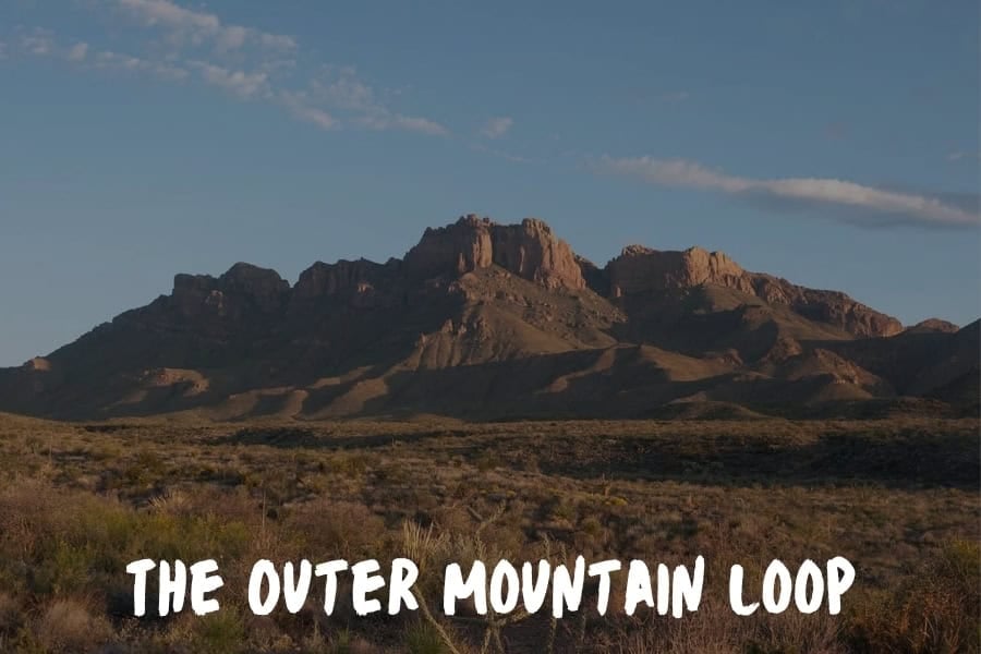
The Outer Mountain Loop is the multi-day option in the same park — a backcountry route requiring a permit, real desert navigation, and several days away from any services.
The Outer Mountain Loop in Big Bend National Park is the one. It's roughly 30 miles through some of the most dramatic desert landscape in the country, and it earns every bit of that reputation.
I did it over three days with a friend a while back, and what hit me was the silence. Not quiet. Silence. The kind where you can hear your own heartbeat after you stop walking. Coming from San Francisco, where I'm glued to screens around the clock, that reset was almost violent in how effective it was.
By day two, my brain was solving problems I hadn't consciously been thinking about. Some of my best product ideas have come from getting completely offline in places like that.
What makes Big Bend special is the variety. You start in the Chisos Basin surrounded by these volcanic peaks, drop down into the desert floor where it's nothing but creosote and open sky, then climb back up through canyons that feel like they belong on another planet. One stretch along the South Rim gives you views into Mexico that go on for what feels like a hundred miles. I remember sitting on a rock ledge eating a terrible dehydrated meal thinking it was the best dinner I'd ever had.
Texas doesn't get enough credit for its trails. People think flat plains and highway. Big Bend is the antidote to that assumption. The terrain is technical enough to keep you engaged but not so brutal that you need mountaineering experience.
The real reason I keep going back to trails like this is simple. Building a company with AI moving as fast as it does requires intense focus, and intense focus requires real recovery. Not scrolling on a couch. Not a spa day. I mean putting yourself somewhere that your phone literally has no signal and your legs have to do the thinking for a while.
The best ideas don't come from more screen time. They come from earning a view that makes you feel small.
Runbo Li, CEO, Magic Hour AI
Guadalupe Peak Trail Climbs 3,000 Feet to the Highest Point in Texas at 8,751 Feet
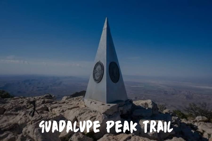
At 8,751 feet, Guadalupe Peak is the highest point in Texas, and the trail leading there gains more elevation in 4.2 miles than almost any other day hike in the state.
The summit sits on what was once an ancient reef, formed when this stretch of West Texas was the floor of a shallow sea roughly 260 million years ago.
The Guadalupe Peak Trail in Guadalupe Mountains National Park covers 8.4 miles round trip and climbs roughly 3,000 feet, switchbacking up exposed limestone before reaching a band of pine and Douglas fir near the top that feels closer to a Rocky Mountain forest than the Chihuahuan Desert below.
Wind at the summit is constant and can exceed 50 miles per hour even on clear days, which is why the metal pyramid marking the peak isn't a photo prop — the exposure up there is real. Spring and fall bring the most stable weather; summer means starting before dawn to avoid both heat and afternoon storms.
Guadalupe Mountains National Park gets a fraction of the visitors that Big Bend does, despite sitting less than three hours away, and the Guadalupe Peak Trail sees light traffic relative to its status as the state's highest point. The elevation gain filters out casual hikers on its own, which means the summit register tends to have fewer names in it than the difficulty of the climb would suggest it should.
The Lighthouse Trail at Palo Duro Canyon Ends at a 310-Foot Hoodoo in the Second-Largest Canyon in the US
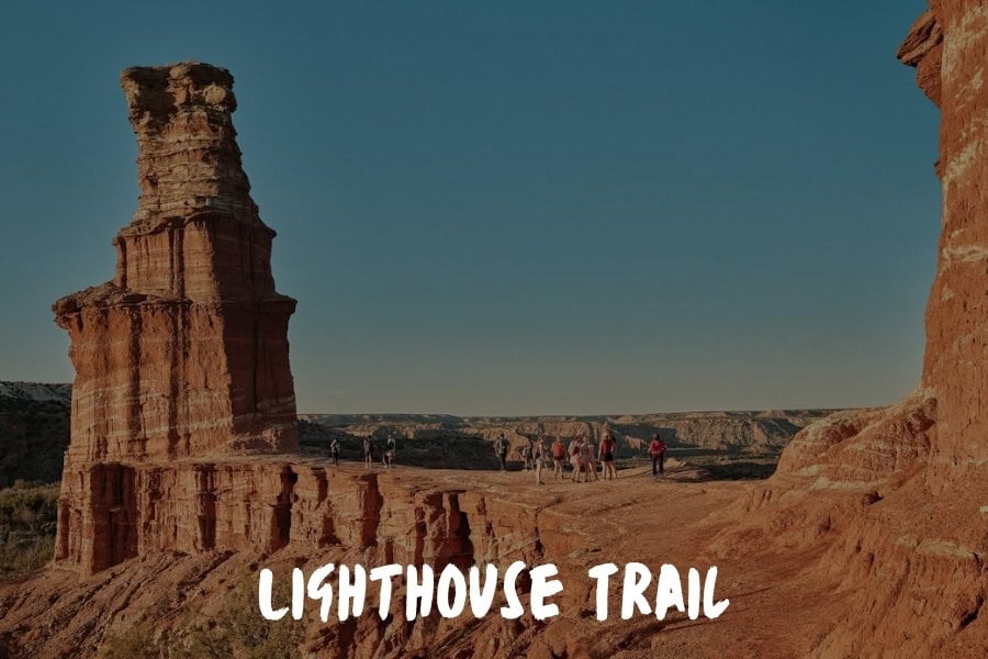
Palo Duro Canyon cuts roughly 800 feet deep into the Texas Panhandle, and at the bottom of the Lighthouse Trail stands a 310-foot hoodoo of red rock and caprock sandstone that gives the trail its name. The canyon is commonly described as the second-largest in the United States, carved by the Prairie Dog Town Fork of the Red River over millions of years.
The round trip on the Lighthouse Trail at Palo Duro Canyon State Park runs 5.9 miles with about 450 feet of elevation gain, almost all of it concentrated in the final scramble up to the formation itself. The surface is loose red dirt and rock for most of the route, then turns to a short, steep climb over slickrock near the end.
Spring and fall are the seasons worth planning around — summer temperatures in the canyon routinely clear 100 degrees with no shade across most of the route.
What keeps this trail from feeling overrun is the heat. Anyone willing to start before 7 a.m. in summer, or simply visit in October or April, gets a canyon that looks like nothing else within a day's drive of Amarillo. The climb to the base of the Lighthouse is short enough for most fitness levels, but the lack of shade means the people who go prepared are the ones who actually make it to the formation rather than turning back at the saddle.
Enchanted Rock's Summit Trail Climbs a Billion-Year-Old Granite Dome With No Switchbacks
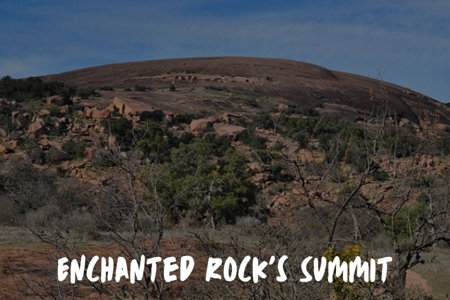
Enchanted Rock is one of the largest exposed granite batholiths in the United States, a single dome of pink rock that pushed up from underground roughly a billion years ago and has been losing its covering of softer stone ever since.
The summit trail climbs directly up that exposed granite face, with no switchbacks and no real trail surface for most of the route — just rock, a steady grade, and painted markers showing the way up.
The round trip on the Summit Trail at Enchanted Rock State Natural Area is short at 1.8 miles, but the climb gains about 425 feet entirely on bare granite, which behaves differently underfoot than dirt or gravel. Traction is good when the rock is dry and notably worse when it's wet, which is one of the few conditions park rangers will actively talk hikers out of summiting in.
Fall through spring is the better window; Hill Country summer heat radiates straight off the exposed rock with no canopy to block it.
The short distance means Enchanted Rock draws a steady crowd nearly any weekend of the year, but the exposed granite surface and total lack of shade mean an early start still gets you a quieter summit than the parking lot would suggest.
The reward at the top: an unobstructed 360-degree view across Hill Country, the same view that led Indigenous peoples in the region to treat the formation as sacred ground long before it became a state park.
Lost Maples' East Trail Loop Turns Hill Country Into New England Color for a Few Weeks Each Fall
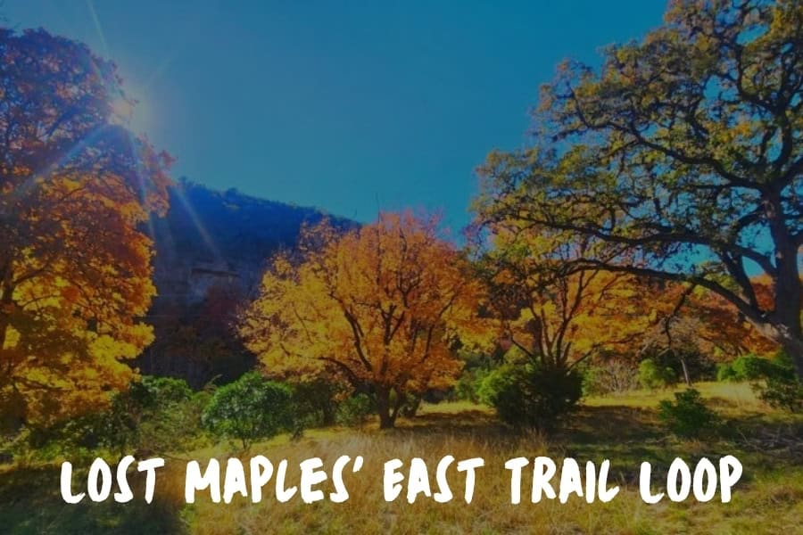
The East Trail loop at Lost Maples State Natural Area runs a little over four miles through rocky hills and shaded canyons that feel out of place in Texas — and for a few weeks each fall, the maples along the route turn a color most people associate with states much farther north.
Lost Maples State Natural Area stands out because it feels different from what most people expect in Texas. The terrain shifts into rocky hills, shaded canyons, and seasonal color that you usually associate with states much farther north.
The East Trail loop, which runs a little over four miles, gives you a steady climb early on, then opens up to views that make the effort worth it. In late fall, the maple trees turn shades of orange and red that draw people in, yet even outside that window the trail has a quiet, tucked away feel that is hard to find.
What makes it special is not just the scenery, it is how the pace naturally slows down once you are on it. There are stretches where you are more focused on your footing and breathing than anything else, which has a way of clearing your head.
A hike like this gives you both physical movement and mental space without needing anything complicated, which is why it tends to stick with people long after they leave the trail.
Belle Florendo, Marketing coordinator, RGV Direct Care
Barton Creek Greenbelt Gives Austin 12 Miles of Dog-Friendly Trail Through Limestone and Creek Crossings
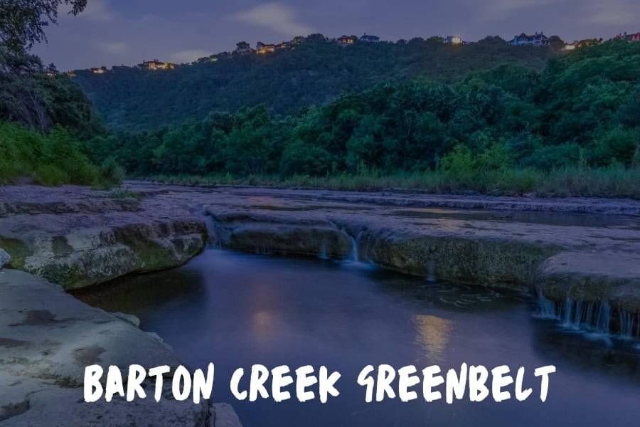
The Barton Creek Greenbelt runs directly through Austin, which means the 12-mile trail system below is one of the few entries on this list that doesn't require a day trip to reach.
My favorite hiking trail in Texas has to be the Barton Creek Greenbelt in Austin. What makes it special is that it is one of the most dog-friendly trail systems in the state. You get about 12 miles of trails winding through limestone cliffs and creek beds, and dogs are welcome on leash throughout.
On any given Saturday morning you will see dozens of families out there with their dogs splashing through the creek crossings.
The Twin Falls section is our go-to recommendation because it gives you a solid workout with some elevation changes, beautiful swimming holes when the water is flowing, and enough shade from the cypress trees to keep everyone comfortable even in the Texas heat.
What really sets the Greenbelt apart from other Texas trails is the accessibility. It runs right through the city so you do not need to plan a whole day trip to get a quality nature experience.
We have heard from so many dog owners through our site that this trail turned their couch potato pups into enthusiastic hikers. For anyone visiting Texas with their dog, this is the trail I always recommend first.
Rina Gutierrez, Part-time Marketing Coordinator, Doggie Park Near Me
The Kirby Nature Trail at Big Thicket Crosses Four Ecosystems in Under Two Miles
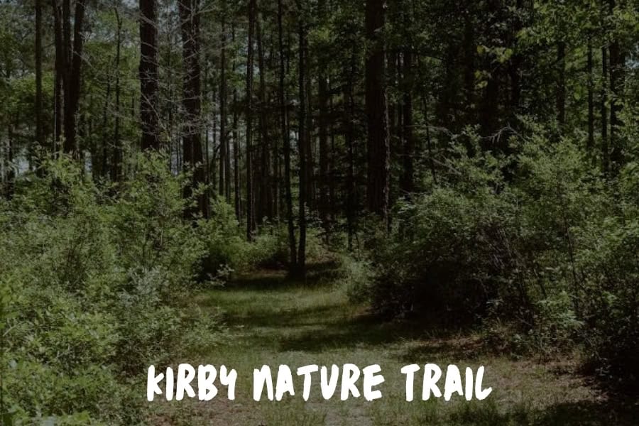
Big Thicket National Preserve has been called the biological crossroads of North America, and the Kirby Nature Trail is where that claim gets tested in under two miles. Pine forest, cypress-lined slough, and sandy upland scrub all sit within a few hundred yards of each other along this loop — a convergence of ecosystem types that doesn't happen at this density almost anywhere else in the country.
The full loop covers 1.7 miles with no meaningful elevation change, on a mix of boardwalk over wetland sections and packed dirt through the pine uplands. Humidity is the defining condition here more than temperature — even on a moderate day, the air under the cypress canopy holds enough moisture that gear dries slowly for the rest of the trip.
Fall and winter avoid both the heaviest mosquito activity and the worst of the East Texas humidity.
Big Thicket doesn't draw the crowds that East Texas's more photographed state parks do, partly because flat, swampy terrain doesn't market itself the way canyon rims or granite domes do.
The reward for going anyway is biodiversity most Texas hikers never encounter on a single trail — carnivorous pitcher plants growing within sight of cactus, a combination that exists in only a handful of places on the continent.
Santa Ana National Wildlife Refuge Turns the Rio Grande Valley Into a World-Class Birding Destination
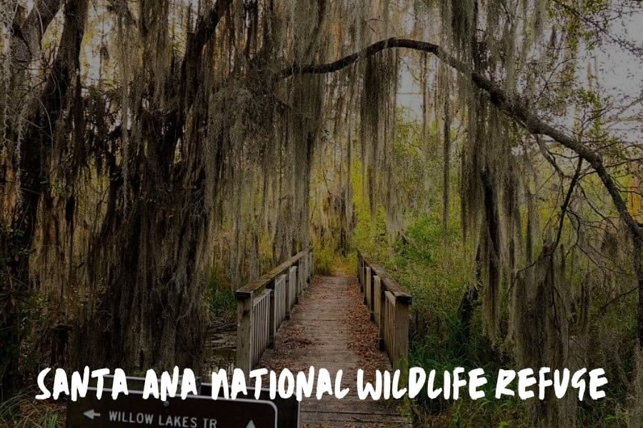
The trail system at Santa Ana National Wildlife Refuge sits directly on the Rio Grande, winding through a stretch of subtropical woodland that reads as a different climate entirely from the rest of Texas. A 12-mile network of trails moves through wetlands, thornscrub, and forest canopy, with an elevated walkway giving an above-ground view of the woods.
I've had the chance to explore quite a few trails across South Texas, and my favorite has to be the Santa Ana National Wildlife Refuge trail system near Alamo, Texas. It's not the most dramatic hike you'll find in the state, but that's part of what makes it special.
The refuge sits right on the Rio Grande, and the trails wind through a rare stretch of subtropical woodland that feels completely different from the rest of Texas. When I'm out there, I don't feel like I'm in the same state where people are hiking desert canyons or pine forests.
The vegetation is thick and green year-round, and the birdwatching is honestly world-class. We get birders from all over the world visiting the RGV specifically for this refuge.
What makes it personally meaningful to me is the connection to our community. Many of the families we help find homes in the Valley don't realize what an incredible natural asset sits right in their backyard. I've started recommending the refuge trails to new residents, and the response is always surprise that something this beautiful exists in South Texas.
The trail system is flat and accessible, making it perfect for families with kids or anyone who wants a peaceful walk rather than a strenuous climb. The 12-mile loop through the refuge takes you through different ecosystems, from wetlands to thornscrub, and there's a canopy walkway that gives you an elevated view of the forest. If you time your visit during migration season, the sheer volume and variety of birds passing through is something you won't forget.
Ydette Macaraeg, Marketing coordinator, Santa Cruz Properties
South Beach Trail at Padre Island Covers Part of the World's Longest Undeveloped Barrier Island
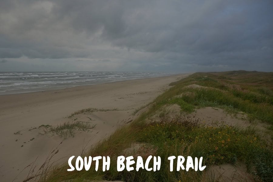
Padre Island National Seashore protects 70 miles of coastline, making it the longest stretch of undeveloped barrier island left in the world.
The South Beach Trail isn't a single fixed loop the way most hikes are — it's a walk along open beach and dune line, with the route length determined by how far you choose to go before turning back.
A common out-and-back covers 8 miles round trip, entirely flat, on a mix of packed sand near the waterline and looser sand higher on the beach. Wind off the Gulf is constant, which keeps the air moving even in summer heat, but also means sun exposure is total — there's no tree line, no dune shade, nothing between you and the sky for the entire route. Fall through spring brings cooler temperatures and fewer biting insects than summer.
Distance is the filter here, not difficulty. Most visitors stay within the first mile near the main access point, so anyone willing to walk three or four miles down the beach gets a stretch of coastline with no other footprints in the sand that morning, and a real chance at watching shorebirds or nesting sea turtles without another hiker in the frame.
Ten Trails, One State That Keeps Getting Underestimated
Run back through what's actually on this list:
- A canyon walk where the Rio Grande slides between rock walls hundreds of feet tall.
- A 30-mile desert loop quiet enough to hear your own pulse.
- The literal highest point in Texas, with wind strong enough to lean into.
- A red-rock hoodoo at the bottom of the Panhandle's own canyon system.
- A billion-year-old granite dome you climb with no trail at all, just rock and paint marks.
- Maple trees turning New England colors in the middle of Hill Country.
- A dog-friendly creek system that starts a few blocks from downtown Austin.
- A swamp where pitcher plants and cactus grow close enough to photograph in the same frame.
- A wildlife refuge that pulls birders in from other continents. A barrier island beach that keeps going for as long as your legs hold out.
That's ten completely different days outside, most of them within a few hours' drive of each other, in a state that gets reduced to flat highway scenery by people who've only ever driven through it.
It's time to get outside!